Welcome to Surveying 1B - Spring 2018:
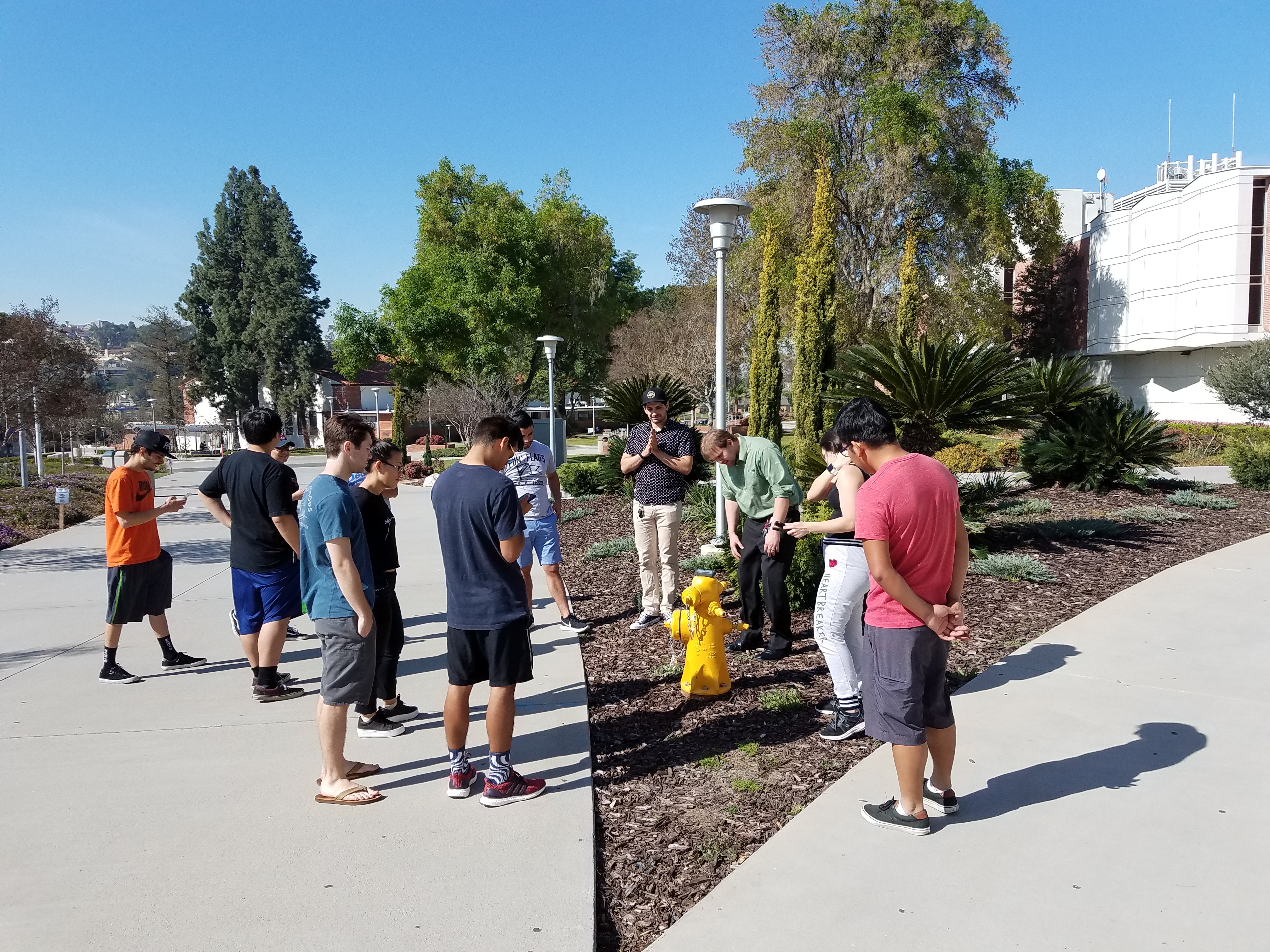
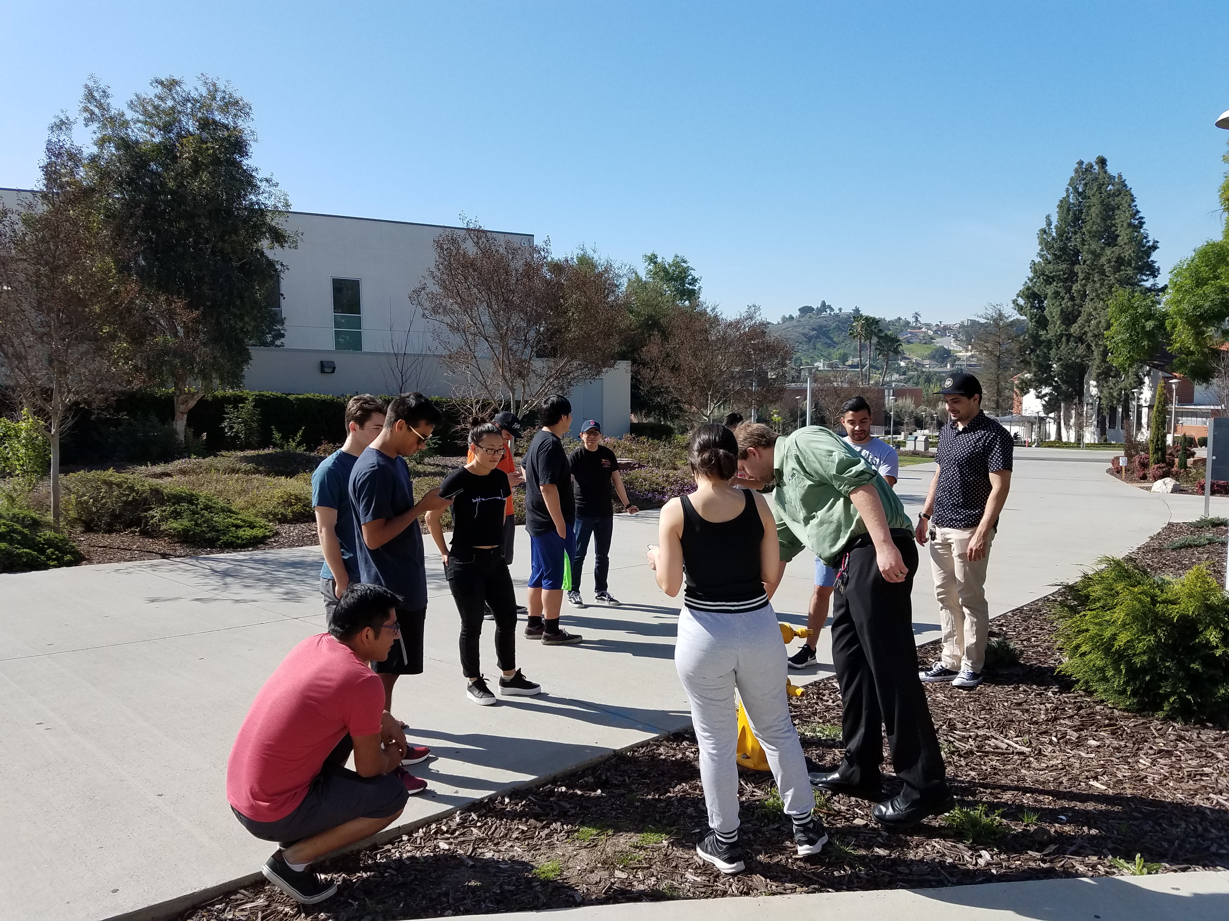
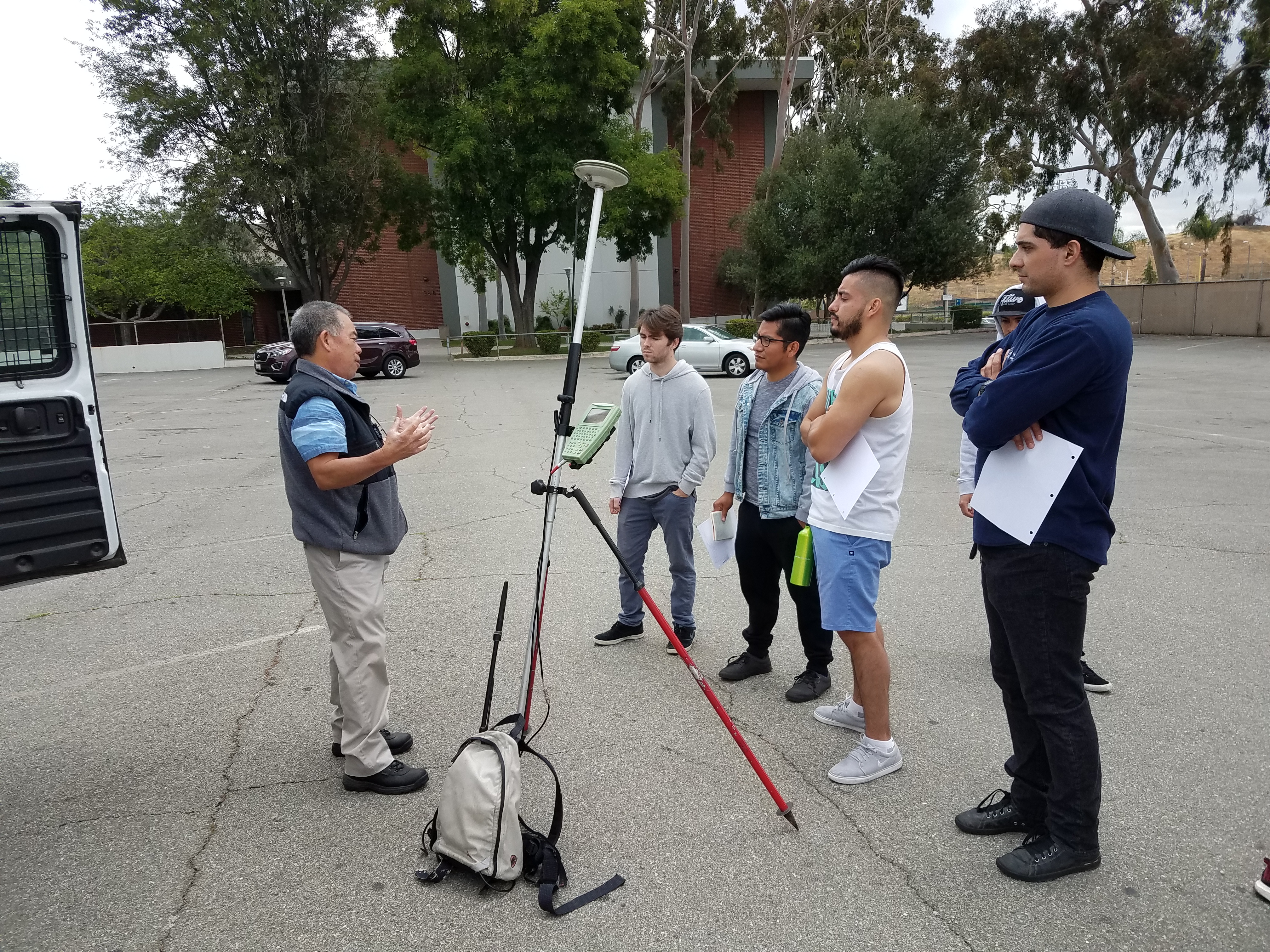
On Friday, March 30, 2018, from 9:00 a.m. to 11:00 a.m., Surveying 1B students participated in a field trip focused on the real-world applications of Global Positioning System (GPS) and Geographic Information Systems (GIS) technology.
This field experience helped students better understand how classroom concepts are applied in professional surveying, mapping, utility management, and public works operations. Topics that may seem abstract in the classroom become much clearer when students see how GPS and GIS tools are used in the field to collect, verify, and manage location-based data.
During the demonstration, Bradley Barnhart, Application Developer with Nobel Systems, showed students how a high-tech Trimble GPS unit can be used to locate and document existing field features, including a fire hydrant. The demonstration gave students a practical look at how modern surveying equipment can quickly and accurately identify real-world positions and connect that information to digital mapping systems.
Although GPS is a complex technology, it becomes easier to understand when approached step by step. With the proper equipment and procedures, GPS can determine an exact position within minutes almost anywhere in the world. This field trip provided students with valuable hands-on exposure to modern surveying technology and showed how GPS and GIS continue to play an important role in engineering, construction, planning, and infrastructure management.
Hello GPS!
Surveying Field Projects – Spring 2022
As part of the Surveying 1B course, students completed a series of hands-on field projects designed to strengthen their understanding of practical surveying methods, field procedures, measurements, calculations, and layout techniques used in engineering and land surveying.
Surveying Field Project 1: Layout of Building Corners
Students practiced establishing and staking building corners based on given dimensions
and control points. This project introduced students to construction layout procedures
and the importance of accuracy when transferring design information from plans to
the field.
Surveying Field Project 2: Determining Building Height
Students used surveying equipment and field measurements to determine the height of
an existing building. This exercise helped students apply trigonometric principles
and vertical angle measurements to solve real-world surveying problems.
Surveying Field Project 3: Layout of a Horizontal Curve
Students performed field layout for a horizontal curve, gaining experience with curve
geometry, stationing, deflection angles, and proper field setup. This project demonstrated
how curves are used in roadway, transportation, and site design.
Surveying Field Project 4: Layout of an Area for Volume Computations
Students collected field data for a designated area and used the information to support
volume computations. This project introduced students to basic earthwork concepts,
including cut-and-fill calculations, surface measurements, and the relationship between
field surveying and construction quantities.
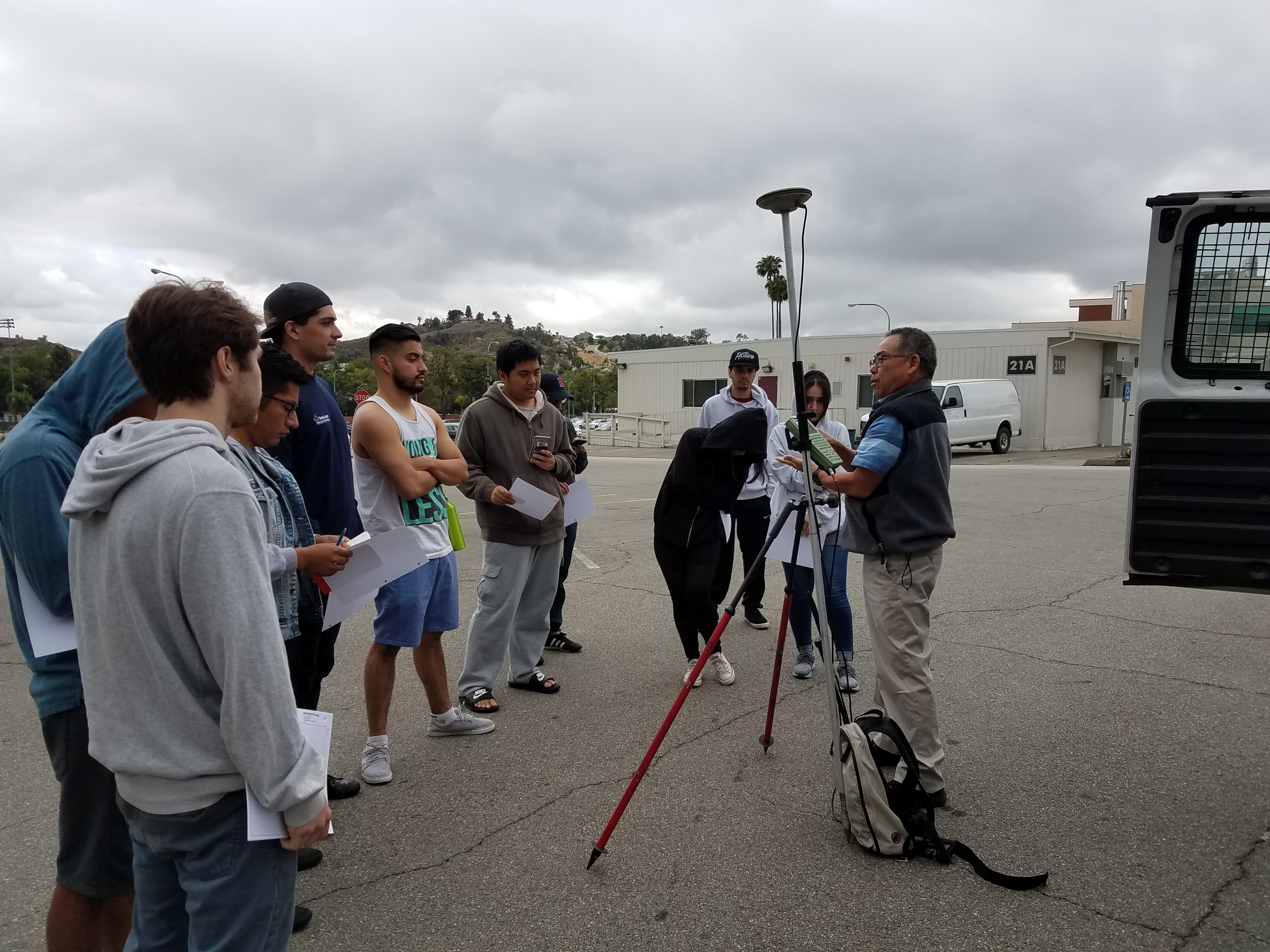
Field Trip No. 2 – High-Tech Land Surveying Demonstration
Spring 2018 | May 26, 2018 | Mt. SAC Parking Lot 18
On May 26, 2018, Surveying 1B students participated in a high-tech land surveying demonstration at Mt. SAC Parking Lot 18. A local professional land surveyor demonstrated a precise and well-coordinated surveying system that combined state-of-the-art field equipment, computerized field data collection, and an office-based CADD system.
The demonstration gave students the opportunity to see how modern surveying technology is used in professional practice. The surveyor demonstrated the use of Trimble RTS Series Robotic Total Station equipment, which allows surveyors to perform layout and measurement tasks more efficiently than with conventional total stations.
One major advantage of a robotic total station is that it can be operated by one person, providing greater flexibility, improved productivity, and potential cost savings in the field. Through this demonstration, students gained valuable exposure to current surveying technology and learned how field data can be collected, transferred, processed, and used in engineering design, construction layout, and land surveying projects.
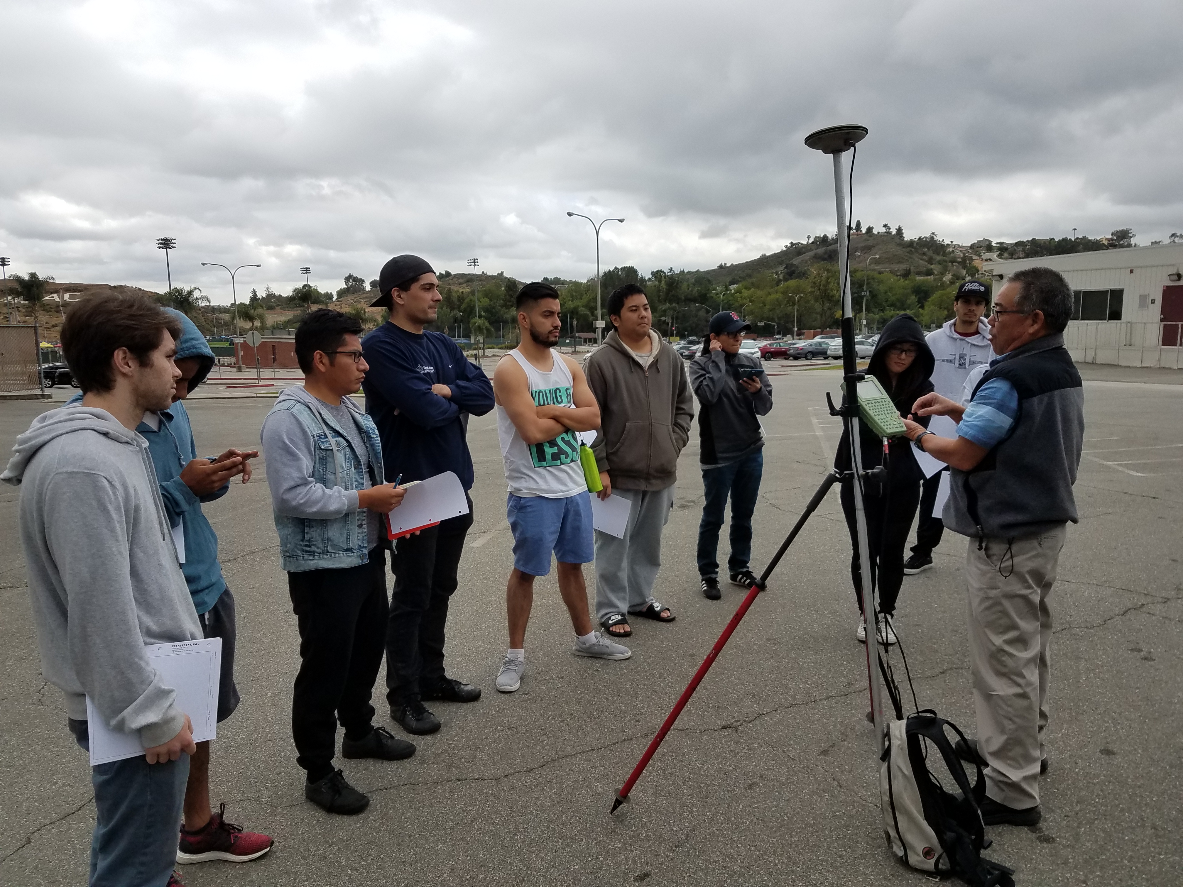
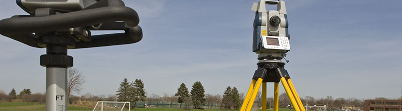
Trimble RTS Series Robotic Total Stations
The Trimble RTS Series Robotic Total Stations are advanced surveying instruments designed to improve accuracy, efficiency, and productivity in the field. Unlike conventional total stations, robotic total stations can be operated by one person, allowing the surveyor to control the instrument remotely while collecting data or performing layout work.
These instruments are commonly used for construction layout, topographic surveys, building layout, utility location, grading verification, and other engineering and land surveying applications. The robotic tracking system allows the instrument to automatically follow the prism, measure distances and angles, and record field data with a high level of precision.
One of the major benefits of the Trimble RTS Series is its ability to reduce field crew size while increasing flexibility and productivity. Field data can also be transferred to computer software and CADD systems for further processing, design, and plan preparation. This technology demonstrates how modern surveying combines traditional measurement principles with advanced equipment, digital data collection, and computer-aided drafting systems.
 mble RTS Series Robotic Total Stations
Final Exam – Field Work: Building Pad Area and Earthwork Quantity Calculations
For the final field examination, students were required to determine the area and earthwork quantities for a proposed building pad. This exercise allowed students to apply the surveying skills and calculation methods learned throughout the course in a practical field setting.
Students collected field measurements, established elevations, and evaluated the existing ground conditions for the proposed pad area. Using the survey data, students calculated the building pad area and estimated the required earthwork quantities, including cut and fill volumes. The assignment emphasized accuracy in field data collection, proper use of surveying equipment, teamwork, and the ability to translate field measurements into useful engineering and construction information.
This final project provided students with hands-on experience in a common civil engineering and construction task: preparing a site for development by determining grading requirements and earthwork quantities.


